-
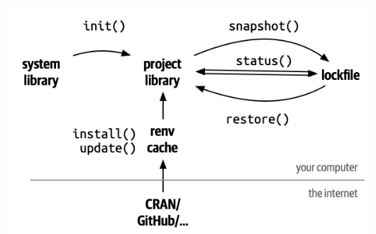


Set up an R-project with me — including pipeline, package management, and version control
In this article, I will walk you through the steps to create a prototype of an R project with pipeline integration, package management, and version control. If you follow these four simple steps, you will be well prepared to tackle any (data-driven) question that comes your way. With version control and package management, we make… Continue Reading
-
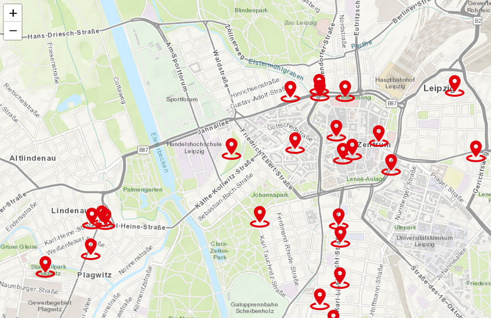
Interactive map with R’s Shiny
A friend asked me to create an interactive map for her. The task was to show places of the democratic movement in Leipzig (Germany) that could later be hosted on a website (Don’t worry, you don’t need to know German to follow along). The map provides information about where these places are (of course), but… Continue Reading
-

Constructing a Calculator-Like Application in Python
For one of my research projects focusing on tax cuts in the fuel market (if you are interested, drop me a line), I had to repeatedly calculate the price reductions and the pass-through rate of the tax cut. So, I took the opportunity to try out the Python library Tkinter. I set up a calculator… Continue Reading
-

Retrieving Open Street Map Data in Python
Open Street Map (OSM) data can be a highly useful tool for obtaining spatial information about your local community. Next to its broad availability, it can be easily obtained via Python. This article shows you how to download OSM data as the one mapped below. The figure shows restaurants in Berlin. The goal is to… Continue Reading
-

Same name, same region?
When traveling through Germany, you might gain the impression that many cities in a particular region have similar names. A pattern that emerged through historical and geographical circumstances. As the country was divided into many smaller entities over centuries, different regions developed their own dialects leading to specific wording. I wondered how similar are the… Continue Reading