


When traveling through Germany, you might gain the impression that many cities in a particular region have similar names. A pattern that emerged through historical and geographical circumstances. As the country was divided into many smaller entities over centuries, different regions developed their own dialects leading to specific wording.
I wondered how similar are the city names. Is it possible to identify clusters of specific names easily on a map? So, let’s get some data and have a look. There are around 11,000 municipalities in Germany in 2020. I focus on name endings to determine similarity. Prominent cases include endings like -bach, -stadt, or -burg.
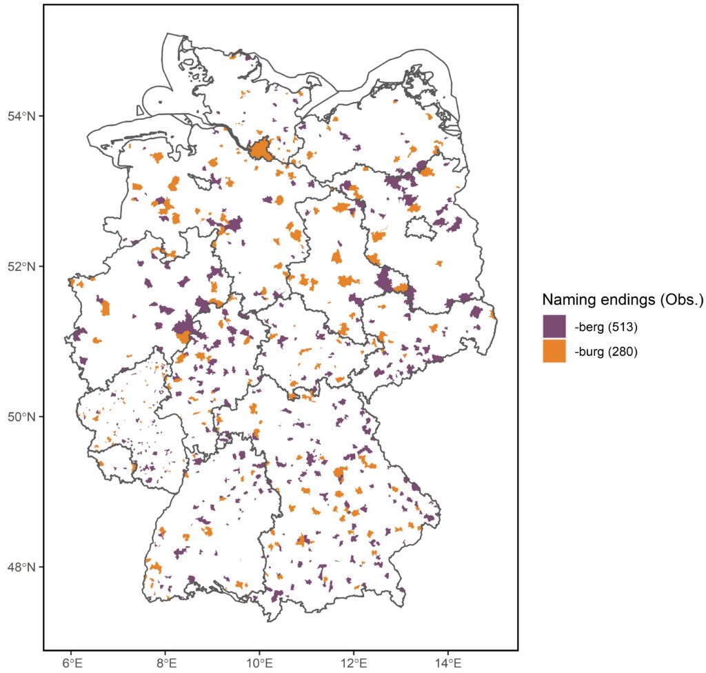
While the endings -berg and -burg appear quite often (793 times in total), there is no clear geographical pattern. Both names seem evenly distributed across the country.
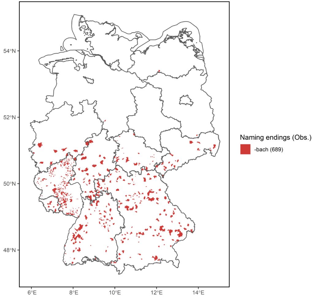
A more interesting case offers the ending -bach. The map visualizes a highly distinct pattern. -bach can be found almost exclusively in the center and South of the country. The single exemption is Gehlsbach in Mecklenburg-Vorpommern in the North. The country is divided near 51°N into -bach and non-bach municipalities.
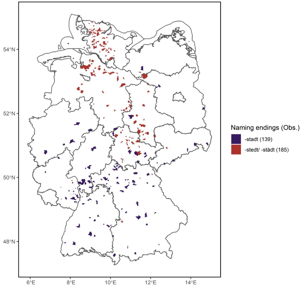
The endings -stadt and -stedt/ -staedt offer another special case. Most municipalities with these endings are located between 8°E and 12°E, so they are more concentrated towards the middle of the country. However, the map also shows a split between red and blue colors. While the center of Germany is somewhat evenly shared, -stedt/ -staedt is more common in the North particularly Lower Saxony and Schleswig-Holstein, the most North of all states.
There you have it! The regional patterns of some German municipalities according to their names.
Source of municipality shape files: Bundesamt für Kartographie und Geodäsie (BKG) – Verwaltungsgebiete (VG250).
Interested in the code behind the maps? Check out my GitHub repository.
Suggestions or questions? Leave a comment or contact me.
Leave a Reply